

Central Asia political map (the five Soviet successor states)

Central Asia topographical map

Central Asia physical map
The above map is available at the author’s website: Free World Maps
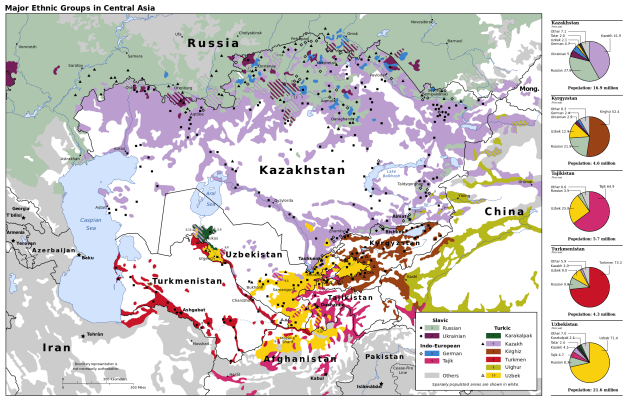
Central Asia ethno-linguistic map (post-Soviet)

Central Asia ethno-linguistic distribution map, including Middle East and the Caucasus (1986)

Distribution of Turkic languages
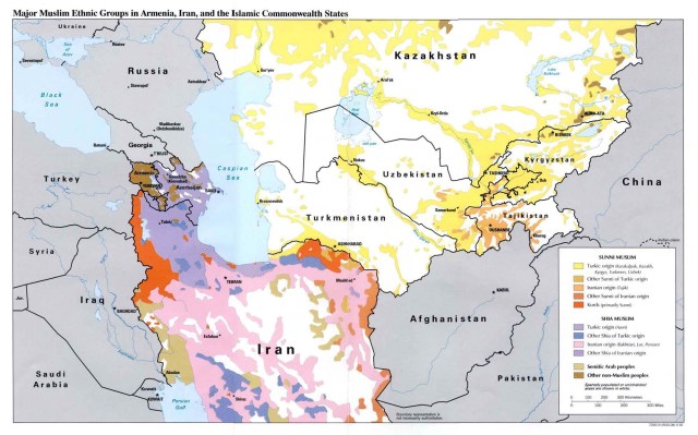
Major Muslim ethnic groups, Central Asia, Iran, the Caucasus (post-Soviet)
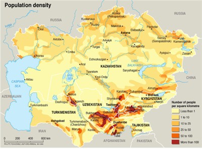
Central Asia population density
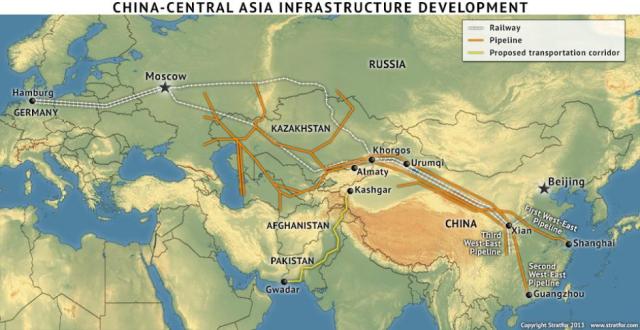
Central Asia infrastructure (Source: Stratfor)

Central Asia water resources and irrigated areas
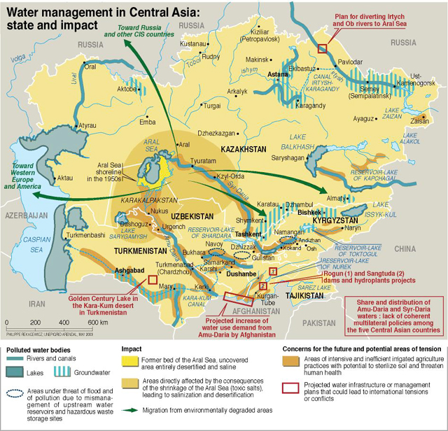
Central Asia water management
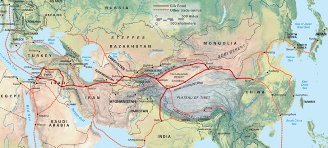
Historical Silk Roads map (one of many available on the web)
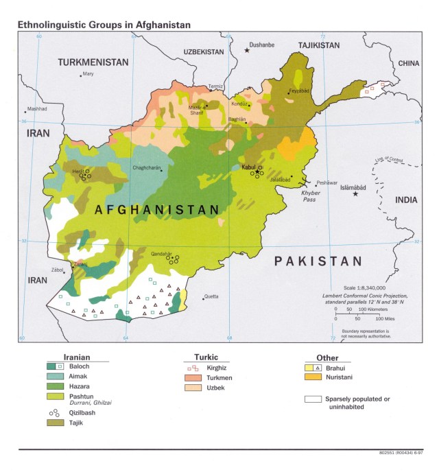
Afghanistan ethno-linguistic distribution map

Xinjiang Uygur Autonomous Region, China

Xinjiang physical map and infrastructure
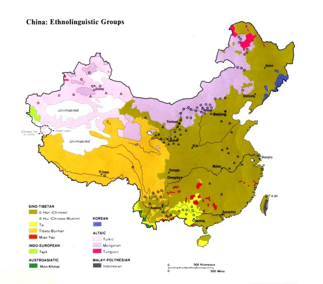
China ethno-linguistic map (include Xinjiang in west)
