
North and South Caucasus physical map

North and South Caucasus ethno-linguistic map

South Caucasus railroad lines
More detailed ethno-linguistic map of the North and South Caucasus, with language family sorting (NB: does not list Mingrelian or Svan as separate languages or some of the smaller linguistic communities in Dagestan)

The most detailed ethno-linguistic map of North and South Caucasus that I am aware of

Political map of North and South Caucasus after Sovietization in 1922
Georgia political map

Ethno-linguistic map of Georgia, 2009
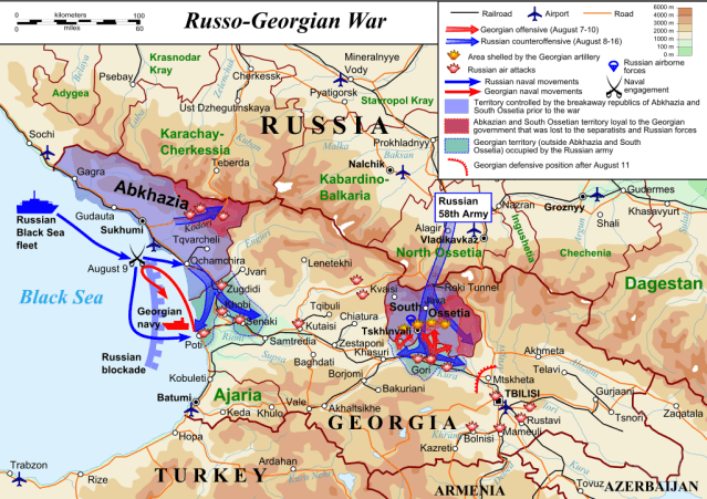
Russian military movements during Russo-Georgian War, August 2008

Abkhazia physical map

UNOMIG operation in Abkhazia before 2008 Russo-Georgian War
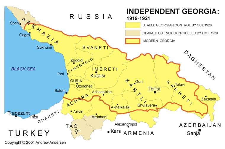
Changing borders of independent Georgia, 1919-21

Georgia “territorial losses” 1921-31

Armenia’s administrative districts


Administrative districts of independent Azerbaijan in 1918-20 versus post-Soviet Azerbaijan

Map of Armenia and Azerbaijan including Nagorno-Karabakh and the neighboring districts controlled by Armenians

Map of Nagorno-Karabakh in late Soviet period

NB: From 1989 Soviet census. Region now circa 95% Armenian, plus small numbers of Assyrians, Greeks, and Kurds.
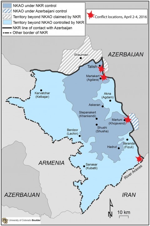
Nagorno-Karabakh and areas of control (U of Colorado, Washington Post)

South Caucasus with major pipelines and Baku-Tbilisi-Kars railway (Source: Heritage Foundation)

Primary zone of fighting, plus territory claimed taken by Azerbaijani forces, March-April 2016 (from LiveUAMap, Caucasus page)
