USSR maps USSR physical map USSR Administrative Divisions (1989): union republics, autonomous republics, oblasts, autonomous oblasts, okrugs USSR’s 15 union republics (SSRs) (1989) 
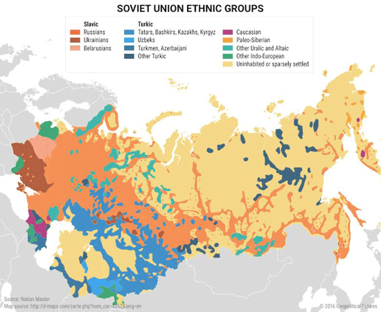
USSR National Geographic ethno-linguistic map (1974) (politically incorrect but heuristically useful) USSR ethno-linguistic distribution map (politically correct but less heuristically useful) USSR population density, 1982 Share this: Share on Reddit (Opens in new window) Reddit Share on X (Opens in new window) X Share on Facebook (Opens in new window) Facebook Share on Tumblr (Opens in new window) Tumblr Share on LinkedIn (Opens in new window) LinkedIn Share on Pocket (Opens in new window) Pocket Share on Pinterest (Opens in new window) Pinterest Print (Opens in new window) Print Email a link to a friend (Opens in new window) Email Like Loading...